


JERSEY CITY, NJ —
July 05, 2026 |
By DailyHudson Staff
National Weather Service warns of potential flooding through Sunday night.
On Friday morning, Jersey City heard the kind of weather alert that makes you double-check your sump pump and make sure the kids have their rain boots by the door. The National Weather Service has issued a flood watch for northeastern New Jersey, including Jersey City, starting Friday afternoon and lasting through Sunday evening.
Here’s what’s actually happening: A slow-moving storm system is pushing up the coast, carrying a lot of moisture from the Gulf. That means repeated bands of heavy rain are expected to park over our area for nearly 48 hours. The NWS says we could see 3 to 5 inches of rain by the time it’s all over. Some spots might get even more.
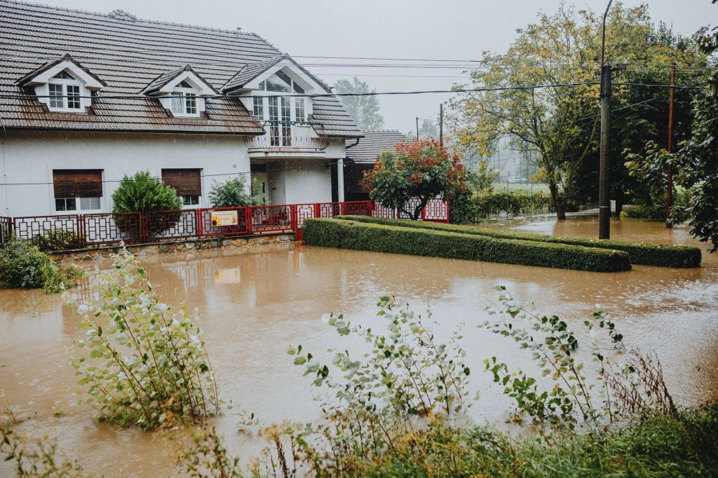
That’s a lot of water for a city that knows flooding. If you live near the Hackensack River, the Morris Canal basin, or any of the low-lying streets near the waterfront, this watch is for you. But even inland neighborhoods like the Heights and Greenville should pay attention. Storm drains clogged with fall leaves can turn a steady rain into a street pond in no time.
The flood watch means conditions are favorable for flooding. It’s not a guarantee, but it’s a heads-up. The biggest concern is urban and small stream flooding, the kind that turns a familiar intersection into a shallow lake and sends muddy water into basements and first-floor apartments. The NWS is also watching the Hackensack River, which could rise above flood stage if the rain comes down hard enough.
How we got here
Jersey City has seen this pattern before. Fall storms that stall over the Northeast have a habit of dropping prodigious amounts of rain. The last major flood event hit in late 2021, when remnants of Hurricane Ida turned city streets into rivers and flooded hundreds of homes. Since then, the city has made some drainage improvements, but the infrastructure is old in many places, and heavy rain still finds the weak spots.
The NWS has been tracking this system for days. Satellite imagery shows a broad area of low pressure spinning its way up the Eastern Seaboard. It’s not a fast-moving storm that blasts through and leaves. This one crawls. That’s what makes it dangerous.
What it means for your Sunday
If you’re a commuter, Sunday night could be tricky. NJ Transit and PATH trains sometimes experience delays or suspensions during flooding, especially if water seeps into underground tunnels or tracks near water level. Check NJ Transit’s website before heading out. For drivers, avoid flooded streets. Turn around, don’t drown — it’s one of those phrases that sounds like a cliché until you see a car floating down Newark Avenue.
For homeowners and renters, now is the time to clear gutters and downspouts. If you have a basement, make sure any valuables are up off the floor. Sandbags are available at some city firehouses — call ahead to confirm. And if you see water rising near your home, don’t wait. Move to higher ground. Better safe than sorry.
City officials have not yet announced any shelter openings, but the Office of Emergency Management is monitoring the situation closely. They urge residents to sign up for Jersey City’s emergency alert system, Alert Jersey City, which sends text and email warnings about weather threats and road closures.
What comes next
The flood watch remains in effect until 8 p.m. Sunday. The NWS will issue updates as the storm develops. Expect more specific warnings — like a flash flood warning for particular neighborhoods — if the rain bands intensify. Follow the National Weather Service’s New York office on social media or tune into NOAA Weather Radio for the most current forecasts. And take it slow, neighbors. This storm will pass, but we’ve got to get through it together.
Source: Jersey City Times